ERDAS Imagine Add-ons
ERDAS IMAGINE LiveLink for Google Earth Engine
An extension to ERDAS IMAGINE's Spatial Model Editor.IMAGINE DSM Extractor
Computer cluster-enabled automatic surface modeling.IMAGINE Terrain Editor
An extensive toolset to edit your terrain data draped directly over a stereo image pair.IMAGINE Photogrammetry (formerly LPS)
Efficiently transform raw imagery into accurate and reliable ortho images, terrain models or point clouds with dozens of rigorous and RPC models.IMAGINE Expansion Pack
Advanced tools for realistic 3D, NITF support, radar DEM extraction, stereo feature collection, wizard-based change detection, and automated image to image registration.ATCOR
Easily reduce atmospheric effects from your imagery to normalize multi-date imagery.IMAGINE Objective
Intuitive Object Based Classification to identify and extract feature data from imagery.IMAGINE SAR Feature extraction
IMAGINE SAR Extracts Features and Information From Your Radar Images.IMAGINE SAR Interferometry
Advanced radar interferometry including coherence change detection, time series change analysis, displacement mapping, and DEM extraction.ERDAS Engine
Expand your processing power by distributing demanding, resource-intensive processes to more cores and workstations.Spatial Modeler SDK
Hexagon Geospatial Developer Network subscription provides a C++ toolkit for building, modifying, and running workflows on geospatial data.
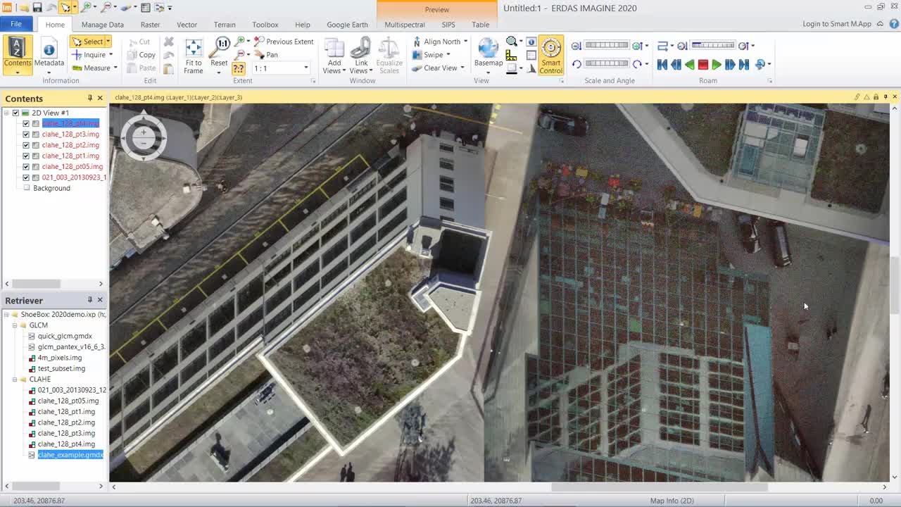

Building Footprint Extraction from Point Cloud Data Tech Talk
Learn how to extract footprints of buildings from LiDAR point cloud data and update a building database.

Enhance the Contrast in Your Imagery and Preserve Detail
Learn how to reveal the detail either in dark areas or in bright areas of your imagery while maintaining detail across the dynamic range.